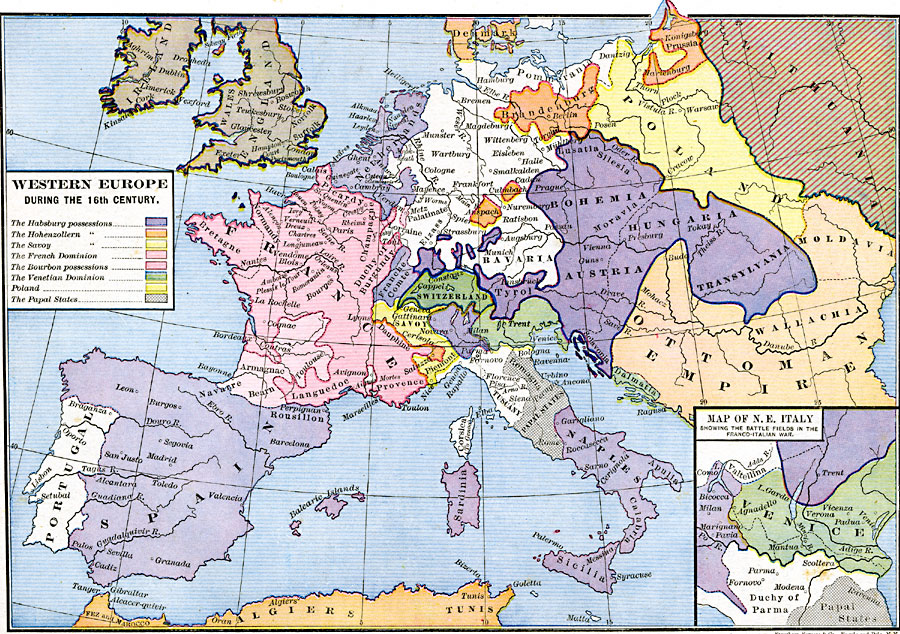
Description: A map of Western Europe during the 16th Century, showing the domains and territories at the time. This map is color–coded to show the territories of the Habsburg possessions, Hohenzollern possessions, Savoy possessions, the French Dominion, Bourbon possessions, the Venetian Dominion, Poland, and the Papal States. The map also shows portions of Lithuania and the Turkish Ottoman Empire in Europe. An inset map shows northeastern Italy with the battlefields of the Franco–Italian War.
Place Names: Western and Central Europe, Austria, �Bohemia, �France, �Italy, �Lithuania, �Netherlands, �Poland, �Portugal, �Spain, �Switzerland, �Transylvania, �United Kingdo
ISO Topic Categories: oceans,
location,
inlandWaters,
boundaries
Keywords: Western Europe, borders, �political, country borders, oceans,
location,
inlandWaters,
boundaries, Unknown, 16th Century
Source: Robert H. Labberton, New Historical Atlas and General History (New York, NY: Townsend MacCoun, 1886) Plate XLIII
Map Credit: Courtesy the private collection of Roy Winkelman |
|