Maps Site map
  Maps > Globes & Multi-Continent > Regional Maps >Regional Atlantic Ocean
Site Map  

  Record   21   to   28  of   28

Regional Globes & Multi-Continental maps of the Regional Atlantic Ocean region from the Maps ETC collection. This may include physical and political maps, early history and empires, climate maps, relief maps, vegetation maps, population density and distribution maps, cultural maps, and economic/resource maps.

Currents of the North Atlantic, 1910
A map of the North Atlantic Basin from 1910, a diagram to show the currents of the North Atlantic. In order to illustrate the currents clearly it has seemed necessary to make them as if they were sharply bounded, like a river in its channel. However,...

The currents of the North Atlantic, 1910
A diagram to show the currents of the North Atlantic. ...

Sketch Chart of the North Atlantic, 1911
This map of the North Atlantic Ocean shows the various steamship routes and the distances of each in miles....

Advance of the Atlantic Tide Crest, 1915
A map of the Atlantic Ocean from 1915 showing the advance of the lunar tidal current. The co–tidal lines represent the points where the high tide occurs at the same time, and the numbers represent the hour of high tide. "Owing to the depth...

Atlantic Currents, 1916
A map of the North Atlantic basin from 1916 showing ocean currents, observed by plotting the courses of drifting bottles. The map shows points where bottles were thrown overboard, where they were recovered, and the direction of their drift. "We ...

Early Transatlantic Flights, 1919
A chart of the routes of the earliest transatlantic fliers. In 1919, the Atlantic Ocean was crossed by airplane and dirigible, British and American aviators sharing the honors. The chart shows the route of the NC–4, a United States Navy Curtiss...

The Atlantic Ocean, 1920
The Atlantic Ocean and the surrounding lands....

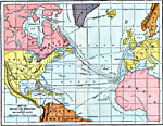
Voyage and Discovery, AD 1000–1650
A map of the Atlantic Ocean showing the early European voyages of discovery to the New World, from Lief Erickson (1001) to Bartholomew Gosnold (1602), and shows the routes of Columbus (1492), Cabot (1497), De Gama (1498), Magellan (1519), and others....

First Previous


  Maps > Globes & Multi-Continent > Regional Maps >Regional Atlantic Ocean
Site Map  

Maps is a part of the Educational Technology Clearinghouse
Produced by the Florida Center for Instructional Technology © 2009
College of Education , University of South Florida