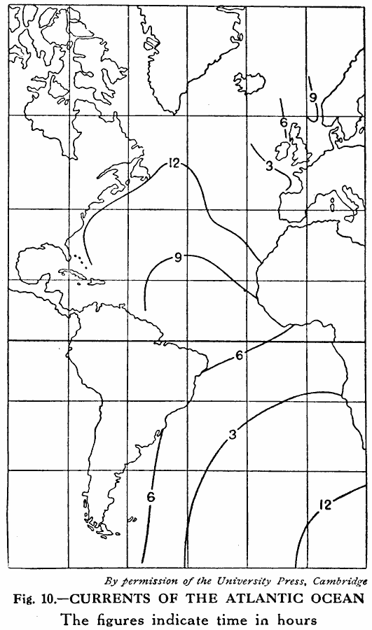
Description: A map of the Atlantic Ocean from 1915 showing the advance of the lunar tidal current. The co–tidal lines represent the points where the high tide occurs at the same time, and the numbers represent the hour of high tide. "Owing to the depth of the oceans and the distribution of land, the high tides do not swing around directly under the moon." — Williams, 1915, p. 167.
Place Names: Regional Atlantic Ocean, Africa, �Europe, �North America, �South Americ
ISO Topic Categories: physical, �hydrological, kOceanCurrents, kWorldAtlantic
Keywords: Advance of the Atlantic Tide Crest, physical, �hydrological, kOceanCurrents, physical features, currents, physical, �hydrological, kOceanCurrents, kWorldAtlantic, Unknown, 1915
Source: Graeme Williams, ed., The World We Live In (London, England: Waverley Book Company, LTD, 1915) 167
Map Credit: Courtesy the private collection of Roy Winkelman |
|