Maps Site map
  Maps > Globes & Multi-Continent > Regional Maps >Regional Mediterranean
Site Map  

  Record   11   to   20  of   60

Regional Globes & Multi-Continental maps of the Regional Mediterranean region from the Maps ETC collection. This may include physical and political maps, early history and empires, climate maps, relief maps, vegetation maps, population density and distribution maps, cultural maps, and economic/resource maps.
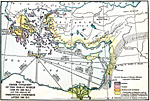
Greek Conquest of the Aegean World and the Spread of Phoenician Commerce, 1500 BC
A map of the Eastern Mediterranean World between1500–1000 BC, showing the extent of the early Greek civilization in the and the spread of Phoenician commerce after 1200 BC. This map is color–coded to distinguish between Dorian, Ionian, A...

Pre–Greek Civilization in the Eastern Mediterranean World, 1500 BC
A map of pre–Greek civilization in the Eastern Mediterranean region around 1500 BC. The map is color–coded to show the territories of the Egyptian, Babylon and Hittite, Phoenician, and the Cretan or &Aelig;gean civilizations. Important ce...

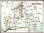
The Spanish Kingdoms and their European dependencies under Charles the Fifth, 1556
A map of southwestern Europe and northwestern Africa showing the Spanish Kingdoms and their European dependencies during the reign of Charles the Fifth. Shows the locations of Mussulmans, Navarre, Castile and Leon, France, and Portugal....

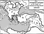
Ottoman Empire at the Death of Suleiman the Magnificent, 1566
A map showing the extent of the Ottoman Empire at the death of Suleiman the Magnificent in 1566. The Ottoman Turks had by this time conquered the Byzantine capital Constantinople (1453), and spread across Anatolia, Armenia, Syria and Mesopotamia, Egy...

The Mediterranean Sea, 1801–1815
A sketch map of the Mediterranean region showing the North African countries of Morocco, Algiers, Tunis, and Tripoli at the time of the Barbary Coast Wars (1801–1805 and 1815) between the United State and Barbary States. "During Jefferson'...

Biblical Egypt, Sinai and Canaan, 1893
A map from 1893 of the of the Egypt, Sinai, and Canaan region showing historical places mentioned in biblical texts....

Turkey of the Future, 1914
This is a map of Turkey during the Ottoman Empire occupation post 1914. "The black area in Asia represents the only territory left under the undisputed sway of the sultan; the black area in Europe may be separated entirely from the realm of Turk...

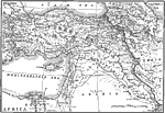
Outline Map of the World's Most Historic Lands, 1916
A map of the Middle East from a 1916 National Geographic article showing the ancient territories of Mesopotamia, Syria, Asia Minor, Kurdistan, and Trans Caucasia. The map shows the more modern boundaries of Turkey in Asia, Russia, Bulgaria, Persia, A...

Mediterranean Sea, 1920
The Mediterranean sea and surrounding lands, showing major railways and steamship routes....

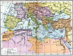
Economic and Commercial Map of the Mediterranean Sea Countries, 1920
Economic and commercial map of the Mediterranean Sea countries. Import and export information is provided....

First Previous Next Last


  Maps > Globes & Multi-Continent > Regional Maps >Regional Mediterranean
Site Map  

Maps is a part of the Educational Technology Clearinghouse
Produced by the Florida Center for Instructional Technology © 2009
College of Education , University of South Florida