|
|
|
| Maps > Globes and Multi-continent > Western Hemisphere |
A collection of political, physical, climate, relief, and early exploration maps of the Western Hemisphere for use in the K-12 classroom.
|
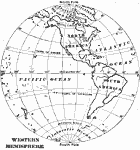
Western Hemisphere,
1909 |
|
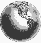
Relief Map of the Western Hemisphere,
1909 |

|
Western Hemisphere,
1910 |
|
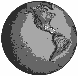
Relif Map of the Western Hemisphere,
1910 |
|
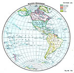
Western Hemisphere,
1916 |
| First | Previous |
| Maps > Globes and Multi-continent > Western Hemisphere |
Maps ETC is a part of the Educational Technology Clearinghouse
Produced by the Florida Center for Instructional Technology © 2009
College of Education, University of South Florida