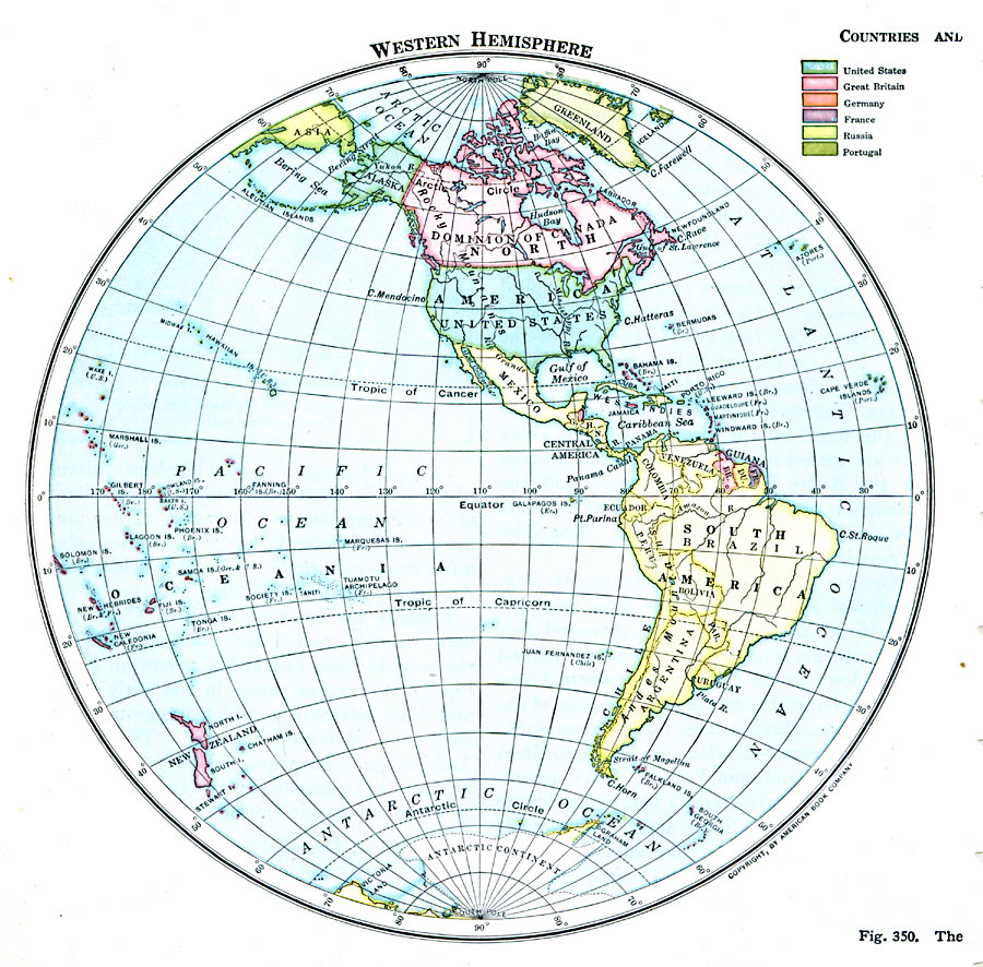
Description: A map of the Western Hemisphere in 1916 showing country borders and the European colonial territorial possessions in the region at the time. The map is color–coded to show the possessions of Britain, France, Netherlands, and the United States possession of Porto Rico.
Place Names: Western Hemisphere, North America, �South America, �Anatarctic
ISO Topic Categories: boundaries,
location,
oceans,
inlandWaters
Keywords: Western Hemisphere, physical, �political, physical features, country borders, boundaries,
location,
oceans,
inlandWaters, Unknown, 1916
Source: Albert Perry Brigham & Charles T. McFarlane, Essentials of Geography (New York, NY: American Book Company, 1916) 240
Map Credit: Courtesy the private collection of Roy Winkelman |
|