| Maps > United States > Louisiana |
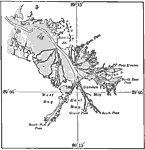
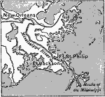 | , A map showing New Orleans and two forts near the mouth of the Mississippi. |
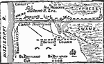 | Battle of New Orleans, A map of the Battle of New Orleans. |
 | Louisiana, Map of Louisiana in 1906. |
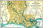
 | Louisiana, A map of the state of Louisiana in 1919, showing railway routes and major cities. |
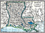
 | Louisiana, A map of Louisiana in 1891. |
 | Mississippi Delta, A map showing the finger-like extensions of the Mississippi dela. The entire area shown as land is swamp-land. |
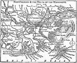 | New Orleans, A map showing New Orleans and the Mississippi Delta. |
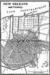 | New Orleans and Vicinity, A map of New Orleans and its vicinity in 1909. |
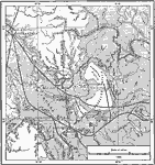 | Red River Below Alexandria, A map showing the diversion of the Red River below Alexandria, La., and location of rapids. Map also shows typical drainage features in the Red River and Mississippi River flood plains. |
| Maps > United States > Louisiana |
Maps is a part of the Educational Technology Clearinghouse
Produced by the Florida Center for Instructional Technology © 2007
College of Education, University of South Florida