Maps Site map
  Maps > United States > Agriculture
Site Map  

  Record   61   to   70  of   141

A collection of agricultural production and agricultural related maps in the United States for use in the K-12 classroom.

United States Production of Hogs, 1900
A map of the United States from the U. S. Department of Agriculture (1923) showing the numbers and location of hogs produced in the United States in 1900. "The most notable increases between 1880 and 1900 were made in Nebraska and Kansas and alo...

Milch Cow Distribution, 1900
A map of the United States from the U. S. Department of Agriculture (1922) showing the distribution of Milch Cows in the United States in 1900. "The census enumerated separately the cows kept principally for milk for the first time in 1900.The e...

United States Cotton Region, 1901
A map from 1901 showing the cotton growing region in the United States....

United States Wheat Regions, 1901
A map from 1901 showing the wheat growing regions in the United States....

United States Tobacco Regions, 1901
A map from 1901 showing the tobacco growing regions in the United States....

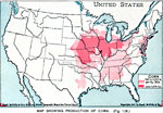
Production of Corn in the United States, 1901
A map from 1901 of the United States showing the principal corn producing areas of the country. The map is keyed to show areas where corn yields are between 640 and 3,200 bushels per square mile, and areas where yields are over 3,200 bushels per squa...

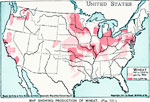
Production of Wheat in the United States, 1901
A map from 1901 of the United States showing the principal wheat producing areas of the country. The map is keyed to show areas where wheat yields are between 640 and 3,200 bushels per square mile, and areas where yields are over 3,200 bushels per sq...

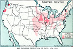
Production of Oats in the United States, 1901
A map from 1901 of the United States showing the principal oat producing areas of the country. The map is keyed to show areas where oat yields are between 160 and 3,200 bushels per square mile, and areas where yields are over 3,200 bushels per square...

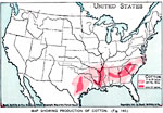
Production of Cotton in the United States, 1901
A map from 1901 of the United States showing the principal cotton producing areas of the country. The map is keyed to show areas where cotton yields are between 5 and 35 bales per square mile, and areas where yields are over 35 bales per square mile....

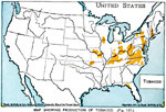
Production of Tobacco in the United States, 1901
A map from 1901 of the United States showing the principal tobacco producing areas of the country....

First Previous Next Last


  Maps > United States > Agriculture
Site Map  

Maps ETC is a part of the Educational Technology Clearinghouse
Produced by the Florida Center for Instructional Technology © 2009
College of Education, University of South Florida