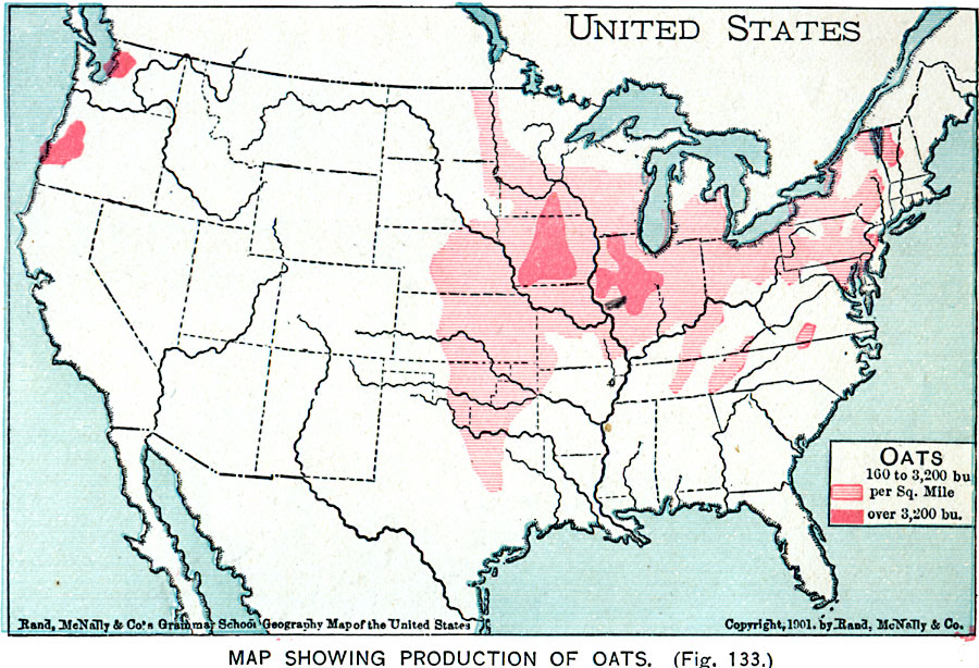
Description: A map from 1901 of the United States showing the principal oat producing areas of the country. The map is keyed to show areas where oat yields are between 160 and 3,200 bushels per square mile, and areas where yields are over 3,200 bushels per square mile.
Place Names: Agriculture, Boston, �Chicago, �Houston, �Los Angeles, �Miami, �New Orleans, �New York, �San Diego, �Seattle, �Washington D.C., �Oat
ISO Topic Categories: oceans,
location,
inlandWaters,
farming
Keywords: Production of Oats in the United States, agriculture, �economic, �industry, �statistical, kAgriculture, agriculture,
industry,
economic, oceans,
location,
inlandWaters,
farming, Unknown, 1901
Source: James A. Bowen, Grammar School Geography (Chicago, IL: Rand, McNally & Company, 1901) 93
Map Credit: Courtesy the private collection of Roy Winkelman |
|