Record
61 to
70 of
73
Historic and contemporary maps of the United States, including physical and political maps, early exploration and colonization period, territorial expansion maps, climate maps, relief maps, population density and distribution maps, vegetation maps, and economic/resource maps.
|
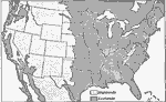
United States Time Zones,
1916
map from 1916 showing the Standard Time Belts in the contiguous 48 states as they were then established. The map notes that on and near the time zone division lines there is some confusion in the time used. Many cities and some railroads in Ohio use...
|
|
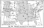
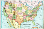
The United States,
1919
A map from 1919 of the continental United States showing state boundaries. The map shows state capitals and major cities, mountain systems, lakes, rivers, and coastal features....
|
|
United States Showing Political Divisions,
1919
A map from 1919 of the Unites States showing state boundaries and capitals, major cities and towns, mountain systems, lakes, rivers, and coastal features....
|
|
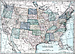
United States,
1920
A map from 1920 of the continental United States showing state boundaries and state capitals, major cities and towns, mountain systems, lakes, rivers, and coastal features....
|
|
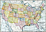
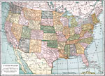
United States,
1920
A map from 1920 of the continental or ‘lower forty–eight’ United States showing state boundaries and state capitals, major cities and towns, mountain systems, lakes, rivers, and coastal features....
|
|
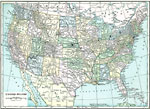
United States,
1920
A map from 1920 of the continental or ‘lower forty–eight’ United States showing state boundaries and state capitals, major cities and towns, mountain systems, lakes, rivers, and coastal features....
|
|
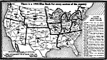
Blue Book for Every Section of the Country,
1920
A map of the United States identifying the regions covered by each volume of the 1920 Blue Book, available from the Automobile Blue Book Publishing Company. ‘All volumes uniform in style, size, and binding. Each $3.00 net.’...
|
|
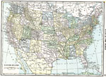
United States,
1921
A map from 1921 of the continental or ‘lower forty–eight’ United States showing state boundaries and state capitals, major cities and towns, mountain systems, lakes, rivers, and coastal features. ...
|
|
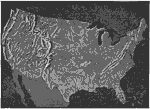
Relief of the United States,
1921
A relief map from 1921 of the United States showing the mountain systems and highlands, plateaus, plains, lakes, rivers, and coastal features....
|
Maps ETC is a part of the Educational Technology Clearinghouse
Produced by the Florida Center for Instructional Technology © 2009
College of Education, University of South Florida