Maps Site map
  Maps > United States > Regional Maps >Northeast States
Site Map  

  Record   1   to   4  of   4

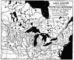
Great Lake Region Bounded by a Terminal Moraine, 1888
Lake region bounded by a terminal moraine extending from Cape Cod west through Dakota. The arrows indicate direction of striae. Eclectic Physical Geography, 1888...

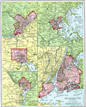
Atlantic Seaports, 1901
Location of sea ports along the Atlantic coast of the United States. ...

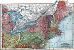
The Northeast United States, 1903
A map from 1903 of the northeastern part of the United States showing state lines and capitals, major cities, railroads and canals, mountains, lakes, rivers, and coastal features of the region....

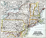
New York, Pennsylvania, and New England States, 1911
Pennsylvania and the New England states, including New York, Vermont, New Hampshire, Maine, Massachusetts, Connecticut and Rhode Island. ...


  Maps > United States > Regional Maps >Northeast States
Site Map  

Maps is a part of the Educational Technology Clearinghouse
Produced by the Florida Center for Instructional Technology © 2009
College of Education , University of South Florida