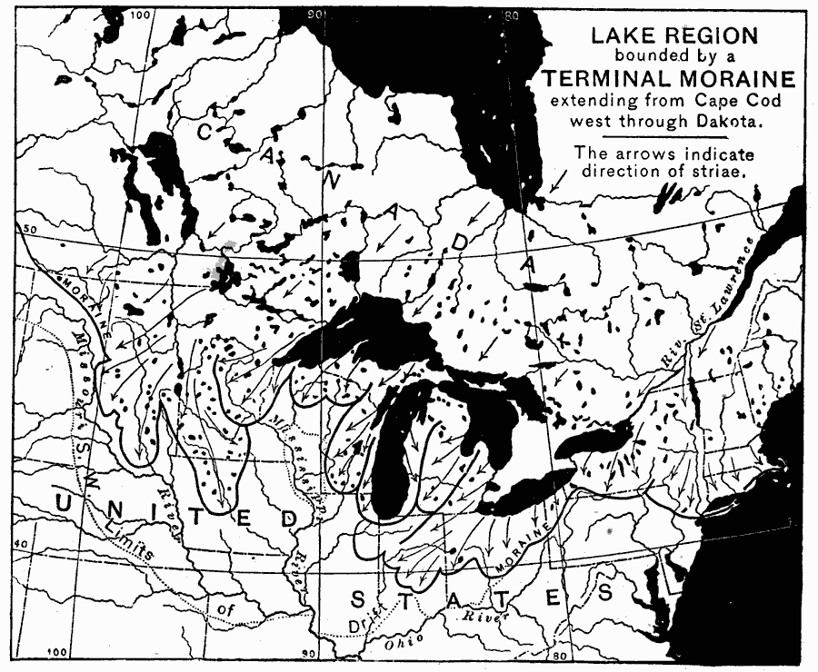
Description: Lake region bounded by a terminal moraine extending from Cape Cod west through Dakota. The arrows indicate direction of striae. Eclectic Physical Geography, 1888
Place Names: Northeastern States, Canada, �St. Lawrence River, �Mississippi River, �Massachusetts, �Cape Cod, �Dakota, �Great Lake
ISO Topic Categories: geoscientificInformation,
oceans,
location,
inlandWaters
Keywords: Great Lake Region Bounded by a Terminal Moraine, physical, kGlacial, physical features, geoscientificInformation,
oceans,
location,
inlandWaters, Unknown, 1888
Source: Russell Hinman, Eclectic Physical Geography (Cincinnati, OH: Houghton Mifflin Company, 1888) 239
Map Credit: Courtesy the private collection of Roy Winkelman |
|