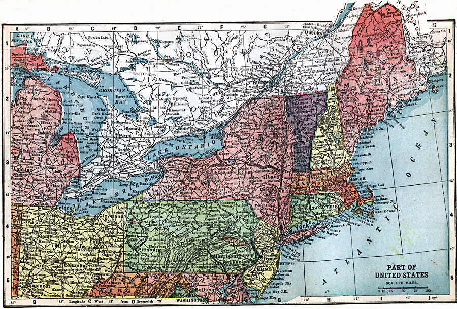
Description: A map from 1903 of the northeastern part of the United States showing state lines and capitals, major cities, railroads and canals, mountains, lakes, rivers, and coastal features of the region.
Place Names: Northeast States, Baltimore, �Philadelphia, �New York, �Boston, �Michigan, ��Ohio, �Pennsylvania, �Maine, �Vermont, �New Hampshire, �Connecticut, �Newport, �New Jersey, �Trenton, �Atlantic Ocea
ISO Topic Categories: transportation,
inlandWaters,
location,
oceans,
boundaries
Keywords: The Northeast United States, physical, �political, �transportation, physical features, country borders,
major political subdivisions, roads, transportation,
inlandWaters,
location,
oceans,
boundaries, Unknown, 1903
Source: W. R. Hearst, The American Almanac, Yearbook Cycopedia and Atlas 2nd ed (Chicago, IL: Hearst's Chicago American, 1903)
Map Credit: Courtesy the private collection of Roy Winkelman |
|