| Maps > United States > South Carolina |
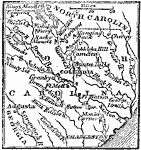 |
Seat of War in South Carolina, 1780 A map showing the seat of the Revolutionary War in South Carolina. |
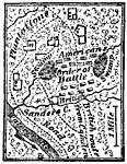 |
Battle of Sanders' Creek, 1780 A map showing the British and American forces at the Battle of Sanders' Creek during the American Revolution. |
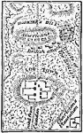 |
Battle of Hobkirk's Hill, 1781 A map showing the Battle of Hobkirk's Hill during the American Revolution. |
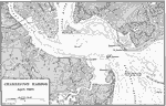 |
Charleston Harbor, 1861 A map of Charleston Harbor in April of 1861. |
 |
Charleston and its Defenses, 1863 A map of Charleston and its defences during the Civil War. |
 |
Vicinity of Charleston, 1872 Charleston, a city and seaport of South Carolina, is situated on a peninsula formed by the union of the Ashley and Cooper Rivers, seven miles from the ocean. |
 |
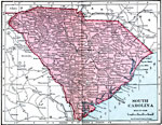
South Carolina, 1891 A map of South Carolina in 1891. |
 |
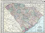
South Carolina, 1906 Map of South Carolina in 1906. |
 |
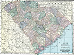
South Carolina, 1912 A map of South Carolina in 1912. |
 |
South Carolina, 1920 Map of South Carolina. |
 |
South Carolina, 1920 Physical map of South Carolina. |
 |
South Carolina, 1920 The state of South Carolina. |
 |
South Carolina, 1922 Physical map of South Carolina. |
| Maps > United States > South Carolina |
Maps is a part of the Educational Technology Clearinghouse
Produced by the Florida Center for Instructional Technology © 2007
College of Education, University of South Florida