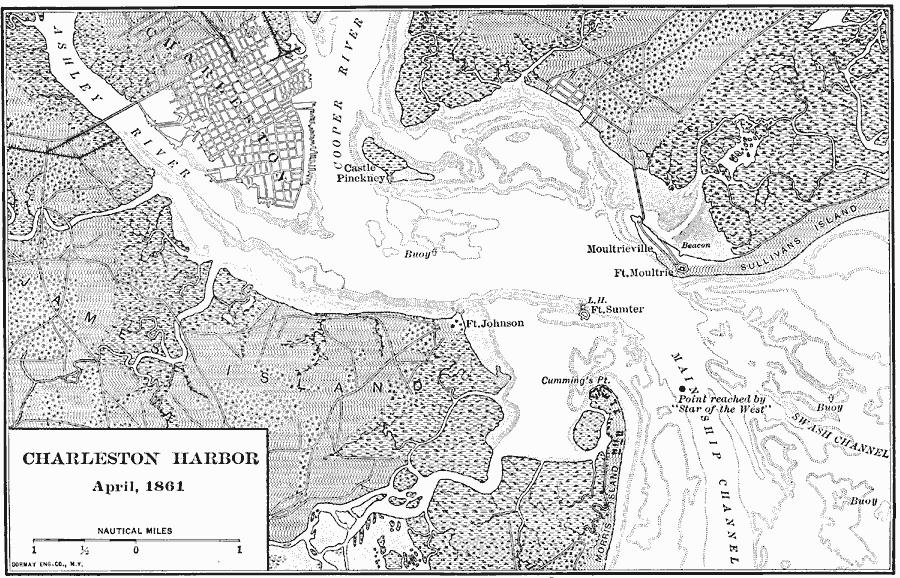
Description: A detailed map of Charleston Harbor, South Carolina, in April, 1861 at the beginning of the American Civil War, and site of the Battle of Fort Sumter (April 12–13, 1861). The map shows the city of Charleston and railroads, rural roads, waterways and submerged features, the Union held Fort Sumter and light house at the mouth of the Charleston Harbor, Confederate held Fort Moultrie on Sullivan's Island on the northern approach to the harbor, and Confederate held Fort Johnson on James Island on the southern approach to the harbor. The map shows the farthest point reached by the ‘Star of the West,’ an unarmed merchant ship sent to relieve Anderson at Fort Sumter, before being repulsed by Confederate artillery fire.
Place Names: Civil War, Charleston, �South Carolin
ISO Topic Categories: boundaries,
oceans,
location,
inlandWaters,
transportation
Keywords: Charleston Harbor, physical, �political, �transportation, physical features, local jurisdictions, roads,
railroads, boundaries,
oceans,
location,
inlandWaters,
transportation, Unknown, 1861
Source: Albert Bushnell Hart, LL.D., The American Nation Vol. 19 (New York, NY: Harper and Brothers, 1907) 244
Map Credit: Courtesy the private collection of Roy Winkelman |
|