|
|
|
| Maps > United States > Transportation |
A collection of historic and contemporary railroad, automobile, and steamship route maps for the United States for use in the K-12 classroom.
|
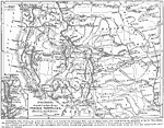
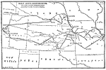
Itineraries described in Captain Marcy's Prairie Traveller,
1843–1868 |
|
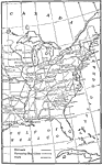
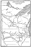
The System of Communication, Western United States,
1850 |
|
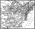
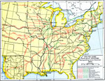
Transportation After Building the Trunk Lines,
1850 |
|
Railroad Lines,
1850–1860 |
|
Trunk Line Railway Systems,
1865–1875 |

|
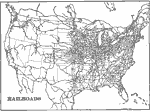
Railroads,
1898 |
|
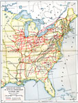
United States Railroads,
1901 |
|
United States showing Important Commercial Routes,
1902 |
|
Long Distance Routes out of Chicago,
1902 |
|
Long Distance Routes from St. Louis to Denver,
1902 |
| First | Previous | Next | Last |
| Maps > United States > Transportation |
Maps ETC is a part of the Educational Technology Clearinghouse
Produced by the Florida Center for Instructional Technology © 2009
College of Education, University of South Florida