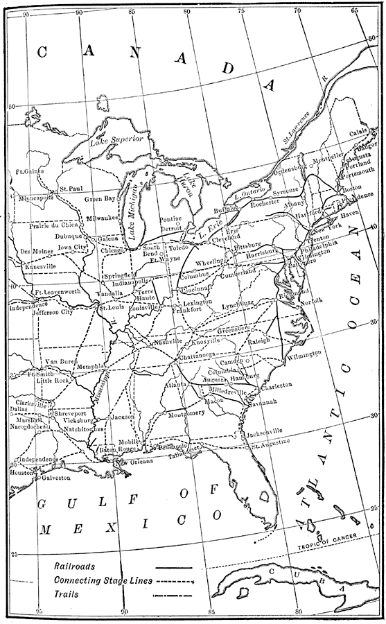
Description: The chief systems of overland travel and communication during the middle nineteenth century including railroads, stage lines, and trails (Oregon Trail, Spanish Trail, Santa Fe Trail, and the Route of the Forty-niners). The system of western forts protecting the trails is shown.
Place Names: Transportation, Portland, �San Francisco, �Sutter's Fort, �Sacramento, �Austin, �Salt Lake City, ���railroad
ISO Topic Categories: inlandWaters,
oceans,
transportation,
boundaries
Keywords: The System of Communication, Western United States, communication,�physical, �railroads, �stagecoach, �trails, �transportation, ��political, kTransportation, physical features, country borders,
major political subdivisions, roads,
railroads, inlandWaters,
oceans,
transportation,
boundaries, Unknown, 1850
Source: Nathaniel Wright Stephenson, An American History (Boston, MA: Ginn and Company, 1913) 378
Map Credit: Courtesy the private collection of Roy Winkelman |
|