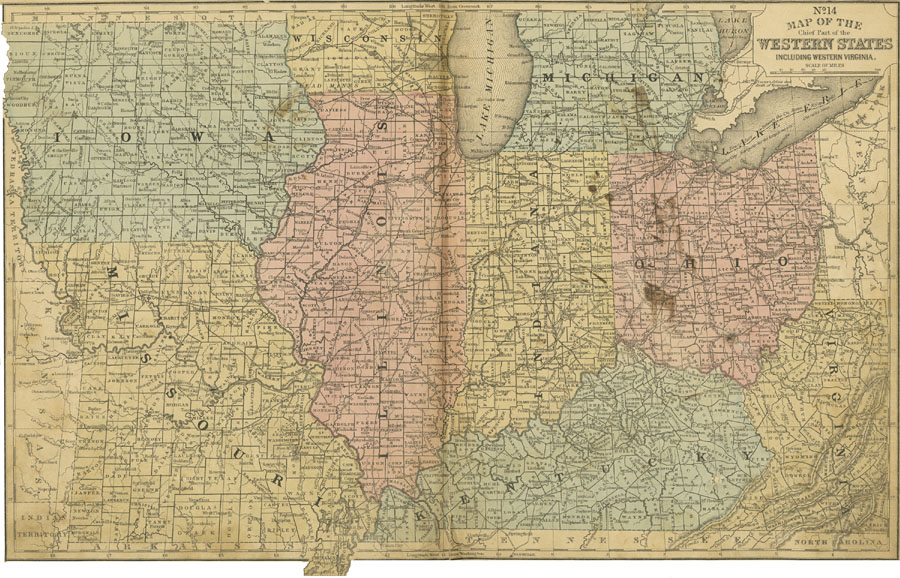
Description: The chief part of the Western States, including Iowa, Wisconsin, Michigan, Ohio, Indiana, Illinois, Missouri, Kentucky, and Virginia along with a small part of Pennsylvania and Canada.
Place Names: Midwest States, Chicago, �Springfield, Columbus, Indianapolis, Madison, Lansing, Jefferson City, Des Moines, Frankfort, Iowa, Missouri, Illinois, Kentucky, Ohio, Indiana, Michigan, Wisconsin, Virginia, �Illinois, �Indiana, �Iowa, �Michigan, �Missouri, �Wisconsi
ISO Topic Categories: boundaries,
inlandWaters,
location,
transportation
Keywords: The Midwestern States, physical, �political, �transportation, �historical, physical features, major political subdivisions,
country borders,
county borders, railroads, American Revolution, boundaries,
inlandWaters,
location,
transportation, Unknown, 1858
Source: , Mitchell's School Atlas (Philadelphia, PA : E. H. Butler & Co., 1863)
Map Credit: Courtesy the private collection of Roy Winkelman |
|