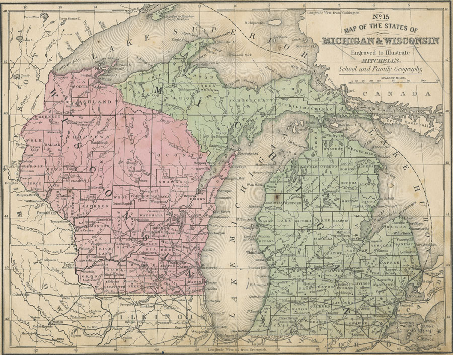
Description: Michigan and Wisconsin including the Great Lakes; Lake Michigan, Lake Superior, and Lake Huron, and parts of Illinois, Indiana, Ohio, and Canada.
Place Names: Midwest States, Chicago, �Lansing, Madison, �Lake Michigan, �Lake Huron, �Lake Superior, �Michigan, �Wisconsi
ISO Topic Categories: boundaries,
inlandWaters,
location,
transportation
Keywords: The States of Michigan and Wisconsin, physical, �political, �transportation, physical features, major political subdivisions,
country borders,
county borders, railroads,
water routes, boundaries,
inlandWaters,
location,
transportation, Unknown, 1858
Source: , Mitchell's School Atlas (Philadelphia, PA : E. H. Butler & Co., 1863)
Map Credit: Courtesy the private collection of Roy Winkelman |
|