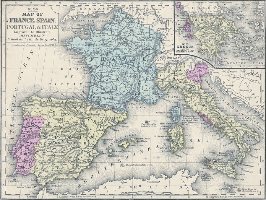
Description: A map of the southern European countries of France, Andorra, Spain, Portugal and Italy in 1861, including an inset map of Greece and the Ionian Islands. This map shows the Papal dominions near Rome, major cities, colleges and universities, significant battle sites, rivers, railways, and sailing distance between major ports. The figures next to cities indicate the population in thousands, next to rivers in hundreds of miles in length, and next to battle sites (flag symbol) as the year of the battle. The elevation of prominent mountain peaks is shown in feet. This American made map shows longitude from the Washington Prime Meridian at the top of the map, and the longitude from the Greenwich Prime Meridian at the bottom. The map also shows much of the Mediterranean Sea, Sardinia, Corsica, Sicily, and parts of Switzerland, Belgium, Austria, England, Algeria and Tunis.
Place Names: Western and Central Europe, France, �Italy, �Spain, �Portugal, �Sardinia, Corsica, Balearic Isles, Monaco, Veneti
ISO Topic Categories: inlandWaters,
location,
oceans,
transportation,
boundaries
Keywords: Map of France, Spain, Portugal, Italy, and Greece, physical, �transportation, �political, physical features, country borders,
major political subdivisions, railroads, inlandWaters,
location,
oceans,
transportation,
boundaries, Unknown, 1858
Source: , Mitchell's School Atlas (Philadelphia, PA : E. H. Butler & Co., 1863)
Map Credit: Courtesy the private collection of Roy Winkelman |
|