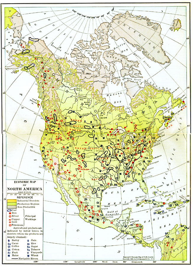
Description: A map from 1916 of North America showing the economic production areas of the region. This map is color–coded to show industrial districts, productive, and non–productive regions. The map shows the principal extraction areas for coal, iron, silver, copper, gold, and petroleum, and the agricultural areas for sheep, cattle, barley, cacao, coffee, cotton, fruit, maize, oats, rice, sugar, tobacco, vineyards, wheat, and the cod fisheries of the northern east coast. Navigable rivers are indicated.
Place Names: A Complete Map of North America, Bahamas, �Canada, �Cuba, �Mexico, �United States, �Greenland, Central Americ
ISO Topic Categories: farming,
boundaries,
economy,
inlandWaters,
location,
oceans,
transportation
Keywords: Economic Activity in North America, physical, �political, �transportation, �statistical, kEconomic, physical features, country borders, agriculture,
industry, water routes, farming,
boundaries,
economy,
inlandWaters,
location,
oceans,
transportation, Polyconic, 1916
Source: , Hammond's Business Atlas of Economic Geography (New York, NY: C.S. Hammond and Co., 1919) 2-3
Map Credit: Courtesy the private collection of Roy Winkelman |
|