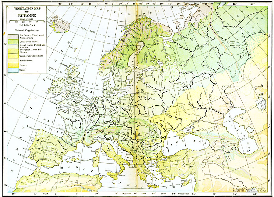
Description: A map of Europe showing areas of different types of natural vegetation including tundra and alpine flora, coniferous forests, broadleaf forests and meadows, temperate grasslands, deserts, and oases.
Place Names: A Complete Map of Europe, Spain, �Portugal, �France, �Germany, �Greece, �Italy, �Sweden, �United Kingdom, �Norway, Bulgaria, Austria Hungary, Russia, Denmark, �Romani
ISO Topic Categories: boundaries,
inlandWaters,
location,
oceans,
biota
Keywords: Vegetation Map of Europe, physical, �political, �statistical, kBiodiversity, physical features, country borders, vegetation, boundaries,
inlandWaters,
location,
oceans,
biota, Polyconic, 1916
Source: , Hammond's Business Atlas of Economic Geography (New York, New York: C.S. Hammond and Co., 1919) 12-13
Map Credit: Courtesy the private collection of Roy Winkelman |
|