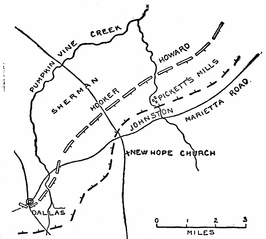
Description: A map of the battle sites of New Hope Church (May 25–26, 1864) and Pickett's Mill (May 27, 1864) during the Atlanta Campaign of the American Civil War (June 14–28, 1864). The map shows the positions of the Union and Confederate armies, rivers, and roads in the area.
Place Names: Georgia, Pumpkin Vine Creek, Marietta Road, New Hope Church, Pickett's Mill
ISO Topic Categories: inlandWaters,
location,
transportation
Keywords: Pickett's Mills and New Hope Church, physical, �political, �historical, �transportation, �american civil war, sherman, hooker, johnston, howard, pickett's mills and new hope church, dallas, kBattle, physical features, roads, Civil War, inlandWaters,
location,
transportation, Unknown, May 1864
Source: Theodore Ayrault Dodge, A Bird's-Eye View of our Civil War (Boston, MA: Houghton, Mifflin and Company, 1897) 232
Map Credit: Courtesy the private collection of Roy Winkelman |
|