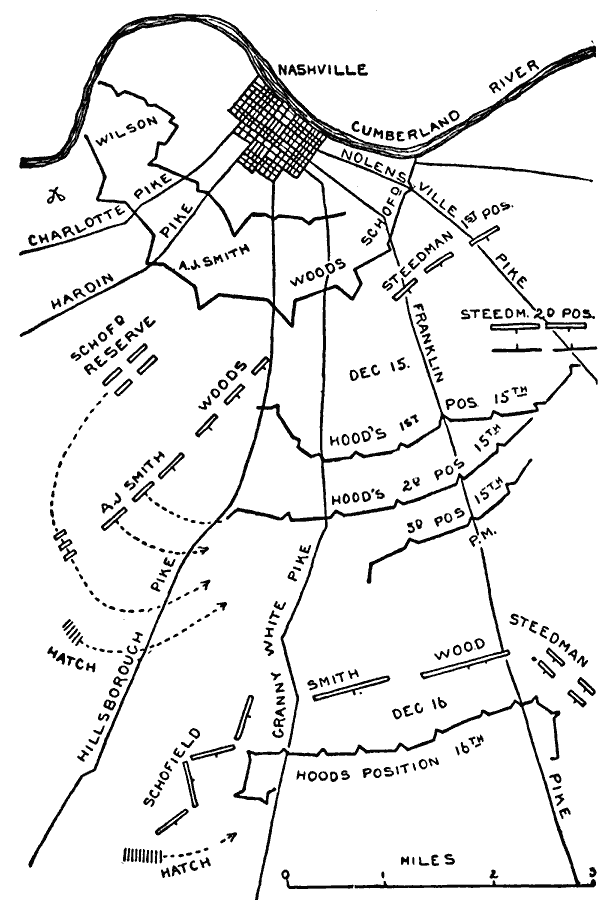
Description: A map of Nashville and the surrounding region, site of the Battle of Nashville. This map shows Union and Confederate positions on December 15–16, 1864.
Place Names: Tennessee, Nashville, Cumberland River, Charlotte Pike, Hardin Pike, Hillsborough Pike, Granny White Pike, Franklin Pike, Nolensville Pik
ISO Topic Categories: inlandWaters,
location,
transportation
Keywords: Battle of Nashville, physical, �political, �historical, �transportation, �american civil war, hatch, hood, schofield, smith, wood, stedman, a. j. smith, wilson, woods, kBattle, physical features, roads, Civil War, inlandWaters,
location,
transportation, Unknown, December 1864
Source: Theodore Ayrault Dodge, A Bird's-Eye View of our Civil War (Boston, MA: Houghton, Mifflin and Company, 1897) 298
Map Credit: Courtesy the private collection of Roy Winkelman |
|