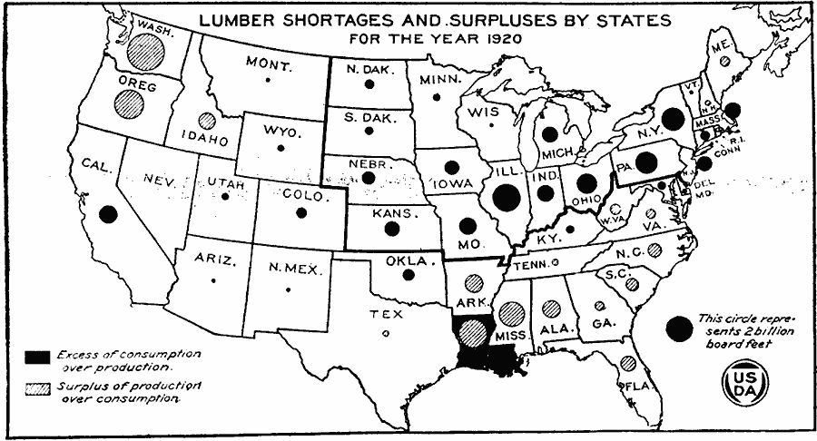
Description: A map of the United States from the U. S. Department of Agriculture (1922) showing the increasing distance lumber had to travel to go from the production areas in the south and west to the consumption areas in the east. The map shows areas of lumper shortages and surpluses by state for 1920.
Place Names: Forestry,
ISO Topic Categories: biota,
boundaries,
inlandWaters,
oceans,
location,
economy
Keywords: Increasing Distance from Lumber Producers to Lumber Consumers, physical, �political, �statistical, �long haul from main lumber producing regions to main consuming region, eastern seaboard consuming, south and west producing, physical features, country borders,
major political subdivisions, industry, biota,
boundaries,
inlandWaters,
oceans,
location,
economy, Unknown, 1920
Source: , United States Department of Agriculture Yearbook 1922 (Washington, DC: Government Printing Office, 1923) 117
Map Credit: Courtesy the private collection of Roy Winkelman |
|