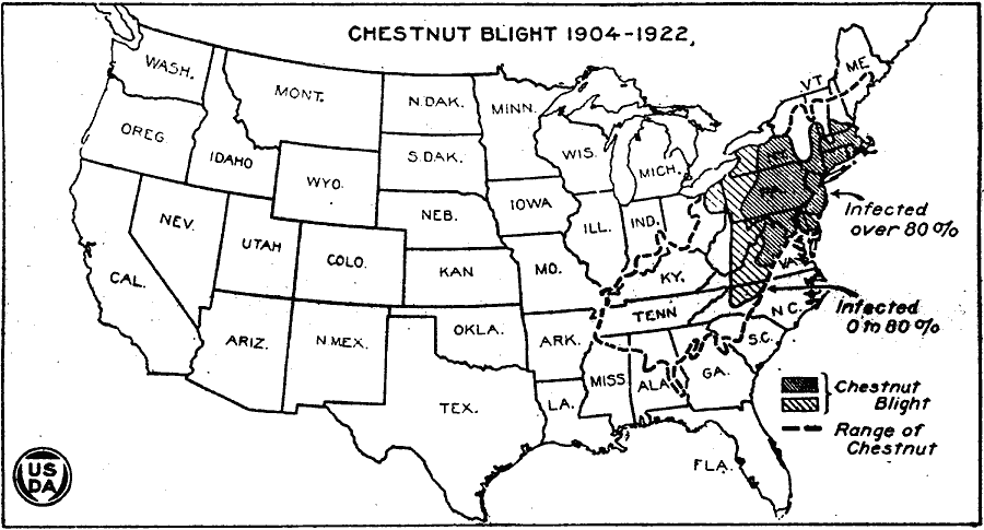
Description: A map of the United States from the U. S. Department of Agriculture (1923) showing the range of chestnut forests and extent of chestnut blight in the Northeast from 1904 to 1922.
Place Names: Forestry,
ISO Topic Categories: boundaries,
inlandWaters,
oceans,
location,
biota
Keywords: Chestnut Blight, physical, �political, �statistical, �the range of chestnut blight from 1904 to 1922, physical features, country borders,
major political subdivisions, vegetation, boundaries,
inlandWaters,
oceans,
location,
biota, Unknown, 1904–1922
Source: , United States Department of Agriculture Yearbook 1922 (Washington, DC: Government Printing Office, 1923) 164
Map Credit: Courtesy the private collection of Roy Winkelman |
|