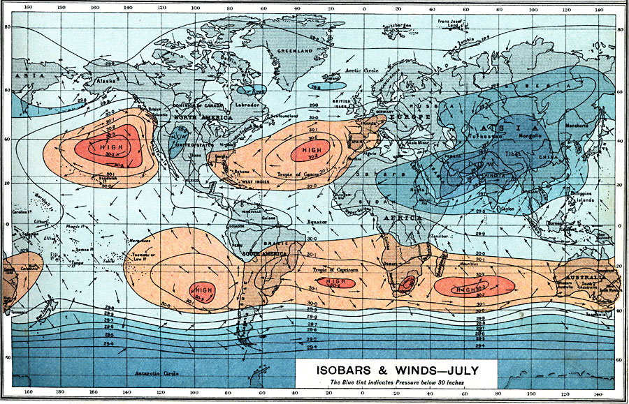
Description: A world map from 1915 showing typical global isobars and winds during July. This map is color–coded to show the areas of high barometric pressure in tans, and areas of low barometric pressure in blues. The dark blue color indicates areas of pressures below 30 inches. Barometric pressures are shown on the isobar lines. Typical wind directions are shown flying with the arrowheads, away from high pressure and towards low pressure areas.
Place Names: A Complete Map of Globes and Multi-continent, South America, �North America, �Europe, �Australia, �Asia, �Antarctica, �Afric
ISO Topic Categories: climatologyMeteorologyAtmosphere,
inlandWaters,
oceans,
location,
boundaries
Keywords: Isobars and Winds - July, physical, �political, �borders, �meteorological, �isobars, �winds, �physical features, country borders, winds, climatologyMeteorologyAtmosphere,
inlandWaters,
oceans,
location,
boundaries, Unknown, 1915
Source: J.G. Bartholomew, A School Economic Atlas (London, England: Oxford University Press, 1915) 5
Map Credit: Courtesy the private collection of Roy Winkelman |
|