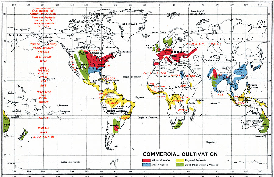
Description: A world map from 1915 showing commercial cultivation throughout the world. This map is color–coded to show regions of wheat and maize cultivation, rice and cotton cultivation, tropical products, and chief stock–rearing regions. Specific crops are labeled, as well as the latitudinal distribution of crops, with the names of the products printed in their approximate latitudes.
Place Names: A Complete Map of Globes and Multi-continent, South America, �North America, �Europe, �Australia, �Asia, �Antarctica, �Afric
ISO Topic Categories: inlandWaters,
oceans,
location,
boundaries,
farming
Keywords: Global Commercial Cultivation, physical, �political, �borders, �statistical, �agriculture, �farming, kAgriculture, physical features, country borders, agriculture, inlandWaters,
oceans,
location,
boundaries,
farming, Unknown, 1915
Source: J.G. Bartholomew, A School Economic Atlas (London, England: Oxford University Press, 1915) 8
Map Credit: Courtesy the private collection of Roy Winkelman |
|