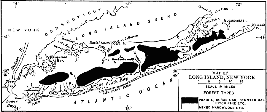
Description: A map from 1911 showing the historic vegetation regions of Long Island, keyed to show the areas of mixed hardwoodw and areas of prairie and open woodlands.
Place Names: New York,
ISO Topic Categories: biota,
inlandWaters,
location,
oceans
Keywords: Vegetation of Long Island, physical, �statistical, physical features, vegetation, biota,
inlandWaters,
location,
oceans, Unknown, 1911
Source: Isaiah Bowman, Ph. D, Forest Physiography (New York, NY: John Wiley and Sons, 1911) 511
Map Credit: Courtesy the private collection of Roy Winkelman |
|