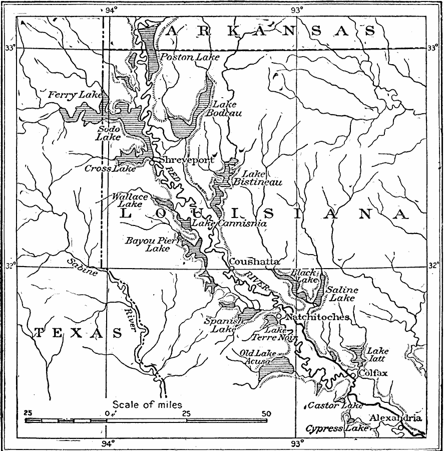
Description: The lakes of the Red River valley in Louisiana at their fullest recorded development.
Place Names: Southern States, Alexandria, �Shreveport, �Colfax, �Louisiana, �Texas, �Mississippi, �Arkansa
ISO Topic Categories: boundaries,
inlandWaters,
location
Keywords: Red River Valley, physical, �political, physical features, major political subdivisions, boundaries,
inlandWaters,
location, Unknown, 1911
Source: Isaiah Bowman, Ph. D, Forest Physiography (New York, NY: John Wiley and Sons, 1911) 534
Map Credit: Courtesy the private collection of Roy Winkelman |
|