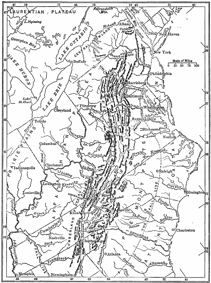
Description: A map from 1911 of the Appalachian mountain system showing the watershed drainage in the Appalachian region. The map shows the Appalachian Plateau, Cumberland Plateau, the ridge system of the Allegheny Front, the Blue Ridge system, Piedmont Plateau, Atlantic Coastal Plain, and indicates the fall line between the Piedmont and coastal plain. The northern features of the central lowlands and Laurentian Plateau of the Great Lakes is also shown.
Place Names: Eastern States, Appalachian Mountains, �Atlantic States, �East Coast, �Piedmont, �Fall Lin
ISO Topic Categories: boundaries,
inlandWaters,
location
Keywords: Drainage of the Appalachian Region, physical, �hydrological, �political, kHydrologic, physical features, major political subdivisions, drainage basins, boundaries,
inlandWaters,
location, Unknown, 1911
Source: Isaiah Bowman, Ph. D, Forest Physiography (New York, NY: John Wiley and Sons, 1911) 587
Map Credit: Courtesy the private collection of Roy Winkelman |
|