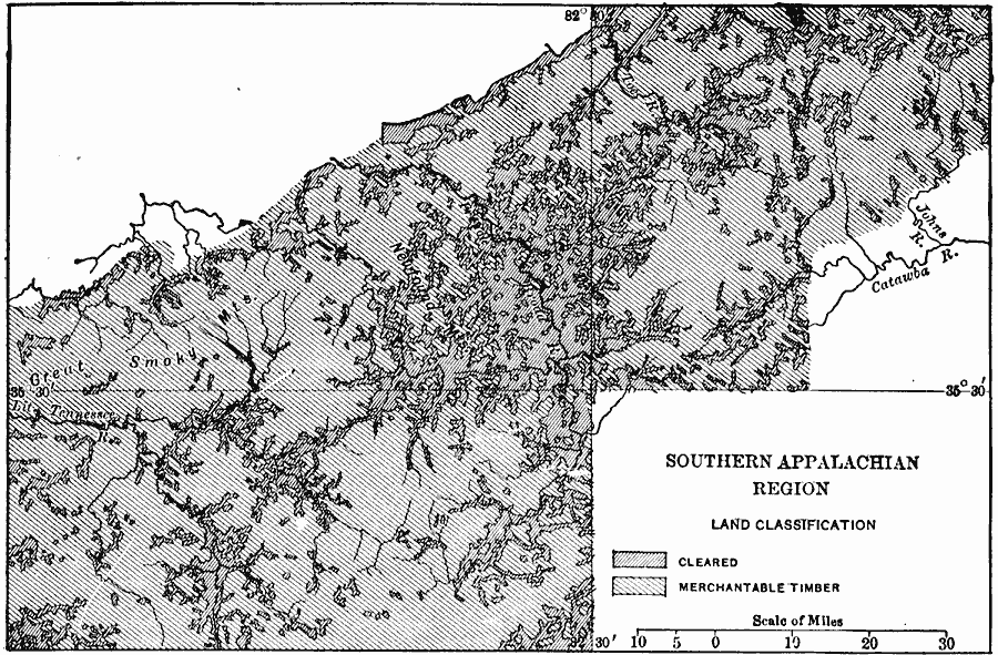
Description: A map of the southern Appalachian region keyed to show cleared lands and merchantable timber land. The large cleared areas lie chiefly in local basins such as the Asheville basin and the valley basins of the Little Tennessee. The smaller isolated areas are largely upon the hill slopes and in the upper and smaller basins or coves.
Place Names: Tennessee,
ISO Topic Categories: biota,
inlandWaters,
location
Keywords: Land Classification of the Southern Appalachian Region, statistical, �physical, physical features, vegetation, biota,
inlandWaters,
location, Unknown, 1911
Source: Isaiah Bowman, Ph. D, Forest Physiography (New York, NY: John Wiley and Sons, 1911) 613
Map Credit: Courtesy the private collection of Roy Winkelman |
|