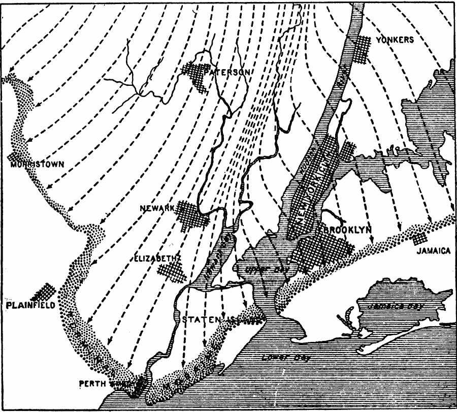
Description: A map from 1911 of the vicinity of New York City showing the extent of the Manhattan prong of the ice–sheet that covered the area during the last glacial period (Wisconsin), keyed to show the direction of the ice flow and terminal moraines in the area.
Place Names: New York, Yonkers, �Brooklyn,�New York City, �Jamaica, �Elizabeth, �Newar
ISO Topic Categories: boundaries,
geoscientificInformation,
inlandWaters,
location
Keywords: Ice Movement in the Vicinity of New York, physical, �political, kGlacial, physical features,
geological, local jurisdictions, boundaries,
geoscientificInformation,
inlandWaters,
location, Unknown, 1911
Source: Isaiah Bowman, Ph. D, Forest Physiography (New York, NY: John Wiley and Sons, 1911) 632
Map Credit: Courtesy the private collection of Roy Winkelman |
|