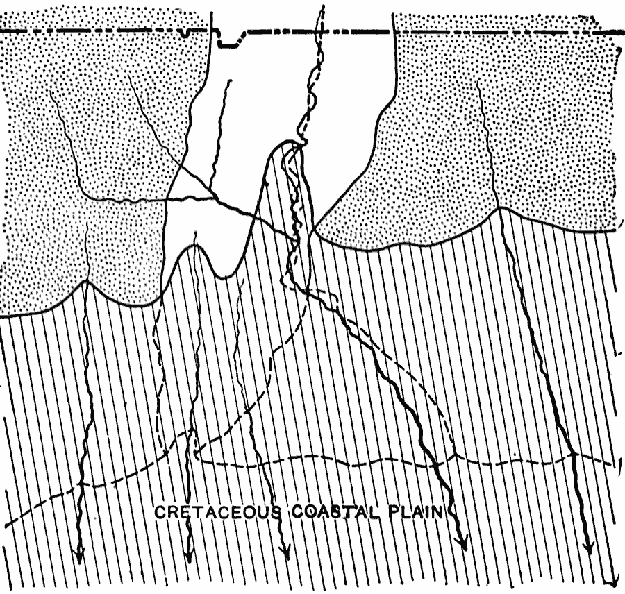
Description: A map from 1911 of the Connecticut River course deviation near Middletown, and the most likely geologic features that explain the course change. The map shows the present Long Island shoreline (dashed line) and the Cretaceous shoreline (solid line) extending further inland. "The Connecticut River, after flowing in a rather direct manner from north to south through the Connecticut Valley lowland, turns almost at right angles at Middletown and cuts through the crystalline rocks of the eastern upland as far as the point of discharge near Saybrook. Such a course could not have been gained during the period of adjustment of streams to structures before the formation of a peneplaned surface. The most reasonable explanation applied to the lower Connecticut is as follows. The Cretaceous clays and sands outcropping upon the northern shore of Long Island formerly extended farther north, overlapping the southern border of the Cretaceous peneplain." — Bowen, 1911, p. 658.
Place Names: Connecticut,
ISO Topic Categories: geoscientificInformation,
location,
boundaries
Keywords: Connecticut Shore Overlap, physical, kGeology, physical features,
geological, geoscientificInformation,
location,
boundaries, Unknown, 1911
Source: Isaiah Bowman, Ph. D, Forest Physiography (New York, NY: John Wiley and Sons, 1911) 658
Map Credit: Courtesy the private collection of Roy Winkelman |
|