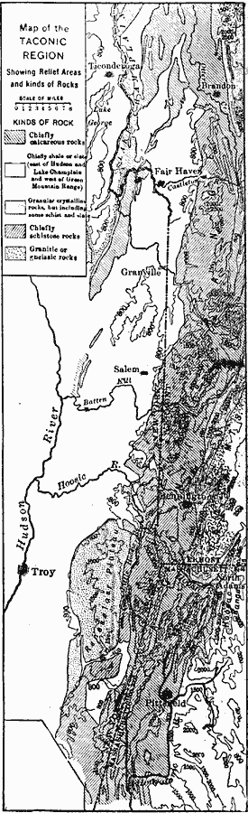
Description: The Taconic region. Contours express elevations and shading expresses rock types. Note the Green Mountains on the right, and in westward succession the valley of western Vermont, the Taconic Range, the Rensselaer Plateau, and the Hudson Valley.
Place Names: New England States, Troy, �New York, �Massachusetts, �Green Mountains, �New York Stat
ISO Topic Categories: boundaries,
inlandWaters,
location,
geoscientificInformation
Keywords: The Taconic Region, physical, �political, kGeology, physical features,
geological, major political subdivisions, boundaries,
inlandWaters,
location,
geoscientificInformation, Unknown, 1911
Source: Isaiah Bowman, Ph. D, Forest Physiography (New York, NY: John Wiley and Sons, 1911) 680
Map Credit: Courtesy the private collection of Roy Winkelman |
|