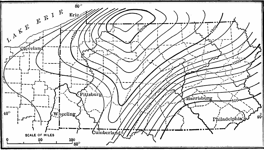
Description: A map from 1911 showing the warped surface of the early Tertiary (Harrisburg) peneplain of the central Appalachians.
Place Names: Pennsylvania, Harrisburg, �Philadelphia, �Pittsbur
ISO Topic Categories: inlandWaters,
location,
boundaries,
geoscientificInformation
Keywords: Tertiary Peneplain of the Central Appalachians, political, �physical, kGeology, physical features,
geological, county borders,
major political subdivisions, inlandWaters,
location,
boundaries,
geoscientificInformation, Unknown, 1911
Source: Isaiah Bowman, Ph. D, Forest Physiography (New York, NY: John Wiley and Sons, 1911) 688
Map Credit: Courtesy the private collection of Roy Winkelman |
|