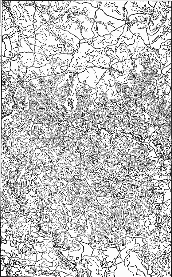
Description: A topographic map from 1911 of the Cumberland Plateau showing elevations given in feet and indicating river systems and valleys in the region. On the right is the summit of the plateau; on the left is the surface of the Highland River; between is a belt of rugged country which marks the descent from the higher to the lower level.
Place Names: Tennessee, Appalachian Mountains, �Kentucky, �Tennesse
ISO Topic Categories: elevation,
location,
inlandWaters,
boundaries
Keywords: Cumberland Plateau, physical, physical features,
topographical, elevation,
location,
inlandWaters,
boundaries, Unknown, 1911
Source: Isaiah Bowman, Ph. D, Forest Physiography (New York, NY: John Wiley and Sons, 1911) 699
Map Credit: Courtesy the private collection of Roy Winkelman |
|