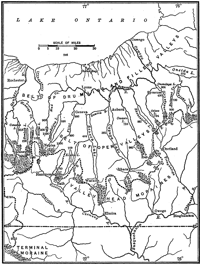
Description: A map from 1911 of the Finger Lakes region of central New York showing the physiographic belts of glacial activity. The map shows the belt of drumlins and filled valleys, the belt of open valleys, and the valleys of the head moraine. The heavy dotted line is on the divide between the St. Lawrence Lowlands and the Appalachian Plateau. Figures represent elevations above sea level.
Place Names: New York, Auburn, �Syracuse, �Ithic
ISO Topic Categories: boundaries,
inlandWaters,
location,
elevation
Keywords: Physiographic Belts in Central New York, physical, kGlacial, physical features,
geological, boundaries,
inlandWaters,
location,
elevation, Unknown, 1911
Source: Isaiah Bowman, Ph. D, Forest Physiography (New York, NY: John Wiley and Sons, 1911) 708
Map Credit: Courtesy the private collection of Roy Winkelman |
|