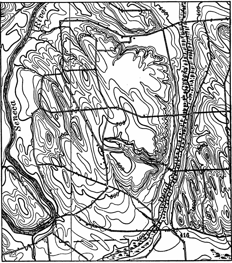
Description: A map from 1911 from the Baldwinsville quadrangle showing the topographic feature of roc drumlins or drumloids. The drumlin-shaped forms in the upper part are developed on shale. Roc drumlins are distinct from the more common type of drumlin in that they are due to erosion rather than the typical up–building.
Place Names: New York,
ISO Topic Categories: inlandWaters,
location,
boundaries,
geoscientificInformation
Keywords: Roc Drumlins, physical, kGlacial, physical features,
geological, inlandWaters,
location,
boundaries,
geoscientificInformation, Unknown, 1911
Source: Isaiah Bowman, Ph. D, Forest Physiography (New York, NY: John Wiley and Sons, 1911) 717
Map Credit: Courtesy the private collection of Roy Winkelman |
|