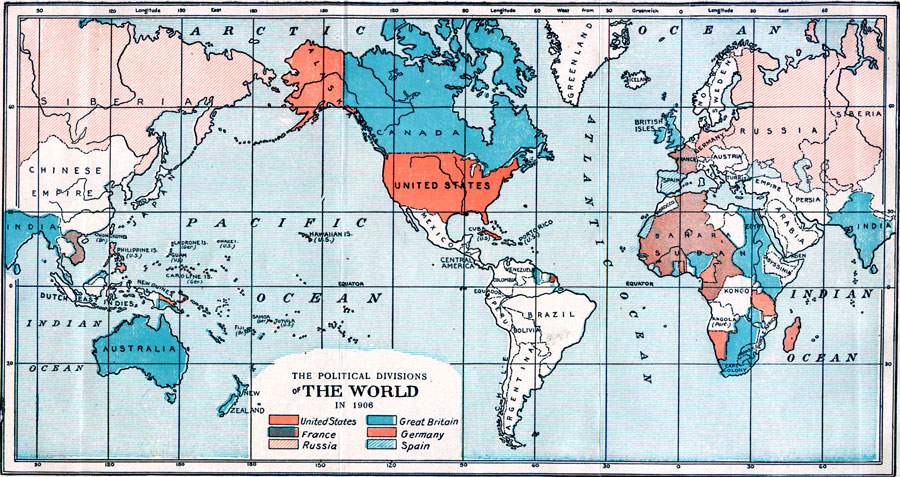
Description: A world map from 1906 showing the political divisions at the time, and is color–coded to show the colonies, territories, and possessions of the United States, France, Russia, Great Britain, Germany, and Spain.
Place Names: A Complete Map of Globes and Multi-continent, Africa, �Asia, �Australia, �Europe, �South America, �North Americ
ISO Topic Categories: boundaries,
inlandWaters,
location,
oceans
Keywords: The Political Divisions of World, political, �physical, physical features, country borders, boundaries,
inlandWaters,
location,
oceans, Unknown, 1906
Source: Edwin Emerson, Jr., The Nineteenth Century and After (New York, NY: P. F. Collier and Son, 1906) 1312
Map Credit: Courtesy the private collection of Roy Winkelman |
|