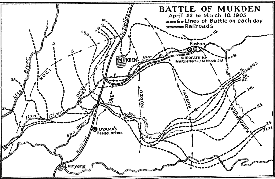
Description: A sketch map of the Manchurian battle site of Mukden, the last major land battle of the Russo–Japanese War (1904–1905). This map is mislabeled, indicating the battle timeframe was April 22 to March 10, 1905. The dates should read February 22 to March 10. The map shows the lines for each day of the battle, with arrows indicating the direction of the Japanese advance and Russian retreat, giving the names of the Japanese commanders leading the push at various locations. The map shows the main railroad, rivers, and the Japanese headquarters of Field Marshal Oyama and the Russian headquarters of General Kuropatkin in Fushan until March 2nd.
Place Names: China, Shenyang, �Mukden, �Liaoyan
ISO Topic Categories: boundaries,
intelligenceMilitary,
inlandWaters,
location
Keywords: Battle of Mukden, transportation, �physical, �political, kBattle, physical features, local jurisdictions, roads,
railroads, boundaries,
intelligenceMilitary,
inlandWaters,
location, Unknown, February 22, 1905–March 10, 1905
Source: Edwin Emerson, Jr., The Nineteenth Century and After (New York, NY: P. F. Collier and Son, 1906) 1317
Map Credit: Courtesy the private collection of Roy Winkelman |
|