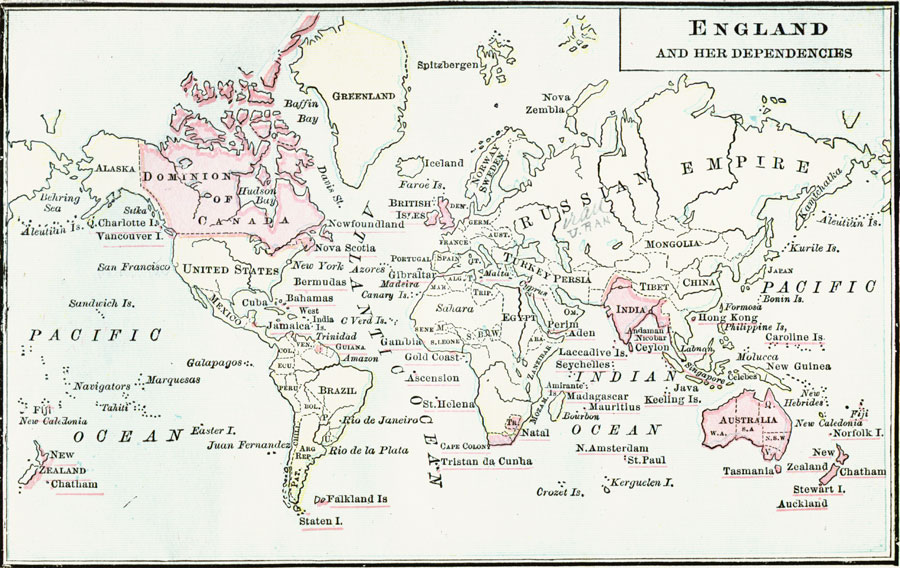
Description: A world map from 1889 showing England and the British dependencies at the time. The map is color–coded to show the British possessions, including islands and smaller territories (names underlined in red).
Place Names: A Complete Map of Globes and Multi-continent, Africa, �Asia, �Australia, �Europe, �North America, �South Americ
ISO Topic Categories: boundaries,
location,
oceans,
planningCadastre
Keywords: England and Her Dependencies, physical, �political, physical features, country borders,
major political subdivisions, boundaries,
location,
oceans,
planningCadastre, Unknown, 1889
Source: John J. Anderson, Ph.D., A School History of England (New York, NY: Effingham Maynard and Co., 1889) front
Map Credit: Courtesy the private collection of Roy Winkelman |
|