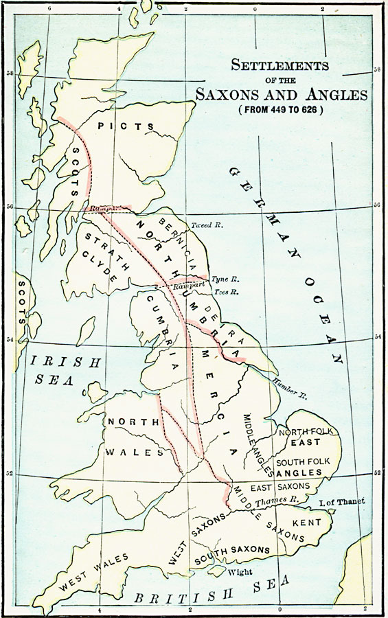
Description: A map of Scotland, England and Wales showing the settlements of the Saxons and Angles from the landing of Hengist and Horsa at Ebbsfleet on the shores of the Isle of Thanet (AD 449) to the Saxon Heptarchy (AD 626). "By these invasions the following states were formed: 1. Kent; 2. Sussex, or the South Saxons; 3. Wessex, or the West Saxons; 4. Essex, or East Saxons, including MiddleSex, or the Middle Saxons; 5. East Anglia, formed by the Angles, originally consisting of two tribes, North-Folk and South-Folk (hence, Norfolk and Sufolk); 6. Northumbria, that is, the country north of the Humber River, which at first consisted of two states, called in Latin De-i'ra and Bernica; 7. Mercia, or the March, or boundary, being situated on the border of Deria and East Anglia. It was conquered by Anglican chieftains in the seventh century (A.D. 626). These seven states constituted what is known in history as the Saxon Heptarchy; although the number of independent Saxon kingdoms was at no time exactly seven." — J. Anderson, 1889, pp. 29-30.
Place Names: United Kingdom,
ISO Topic Categories: boundaries,
inlandWaters,
location,
oceans
Keywords: Settlements of the Saxons and Angles, statistical, �political, �physical, physical features, major political subdivisions, ethnological, boundaries,
inlandWaters,
location,
oceans, Unknown, AD 449–626
Source: John J. Anderson, Ph.D., A School History of England (New York, NY: Effingham Maynard and Co., 1889) 28
Map Credit: Courtesy the private collection of Roy Winkelman |
|