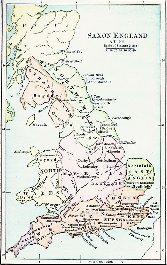
Description: A map of Saxon England in the Middle Ages at the time of Alfred the Great (AD 900) showing the Anglo–Saxon kingdoms of Northumbria, Strathclyde, Mercia, North Wales, East Anglia, Essex, West Wales, Wessex, and Kent. Important cities of the time are shown with their Saxon names, and several battle sites.
Place Names: United Kingdom, Southfolk, �Essex, �Kent, �Derby, �Nottingha
ISO Topic Categories: boundaries,
inlandWaters,
oceans,
location
Keywords: Saxon England, physical, �political, physical features, major political subdivisions, boundaries,
inlandWaters,
oceans,
location, Unknown, AD 900
Source: John J. Anderson, Ph.D., A School History of England (New York, NY: Effingham Maynard and Co., 1889) 41
Map Credit: Courtesy the private collection of Roy Winkelman |
|