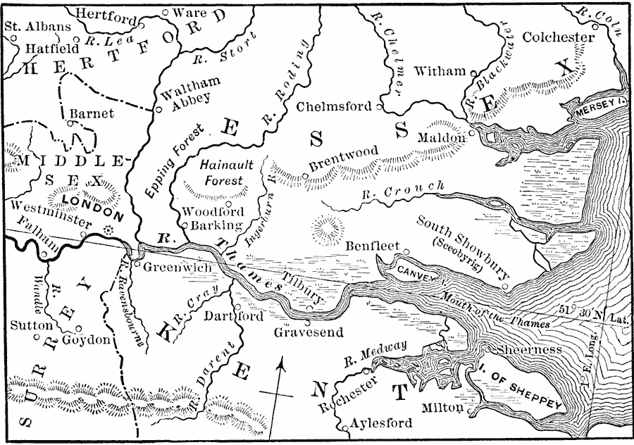
Description: A map of the area from London to the Mouth of the Thames from the time of the foundation of the English Monarchy under Ecgbert (Egbert), King of Wessex (AD 827) to the Norman Conquest (1066). This map shows the city of London in Middlesex, and cities and towns in portions of Hertford, Essex, Surry, and Kent.The map shows rivers, terrain, and the islands of Mersey, Canvey, and the Isle of Sheppey.
Place Names: United Kingdom, London, �Kent, �Essex, �Middlesex, �Milto
ISO Topic Categories: boundaries,
inlandWaters,
location,
oceans
Keywords: London Area, physical, �political, physical features, local jurisdictions, boundaries,
inlandWaters,
location,
oceans, Unknown, AD 827–1066
Source: John J. Anderson, Ph.D., A School History of England (New York, NY: Effingham Maynard and Co., 1889) 41
Map Credit: Courtesy the private collection of Roy Winkelman |
|