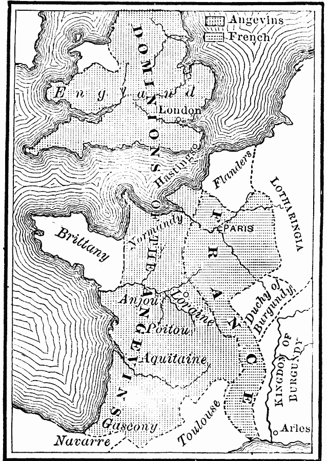
Description: A map showing the dominions of the Angevins in southern England and France in 1216 at the time of Henry III (House of Plantagenet). The map is keyed to show the territories of the Angevins and French, and includes the territories of Flanders, Lotharingia, Brittany, Duchy of Burgundy, Kingdom of Burgundy, Navarre, and Toulouse.
Place Names: Western Europe, France, � England, London, Paris, Normandy, Anjou, Loraine, Poitou, Aquitaine, Gascony, Arles
ISO Topic Categories: boundaries,
inlandWaters,
location,
oceans
Keywords: Dominions of the Angevins, physical, �political, physical features, major political subdivisions, boundaries,
inlandWaters,
location,
oceans, Unknown, 1216
Source: John J. Anderson, Ph.D., A School History of England (New York, NY: Effingham Maynard and Co., 1889) 96
Map Credit: Courtesy the private collection of Roy Winkelman |
|