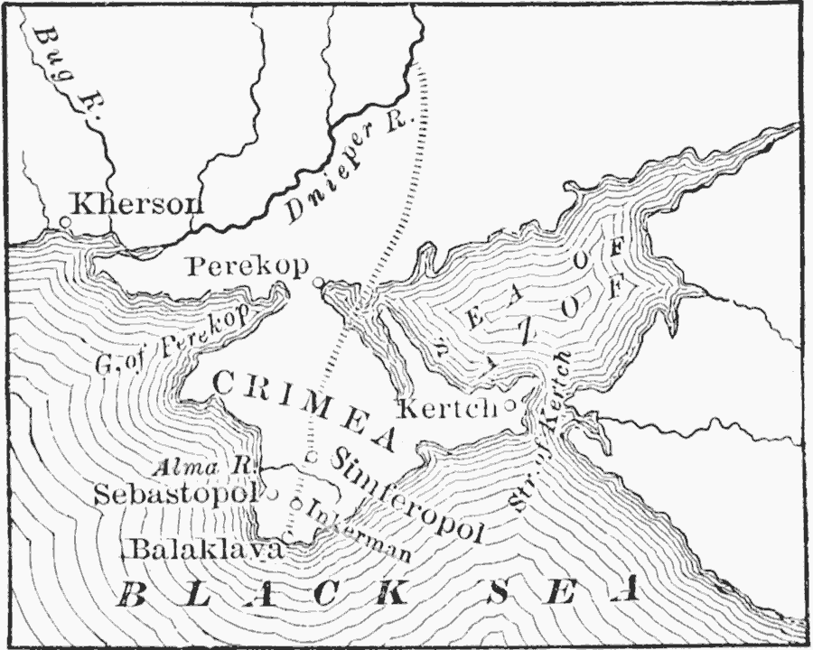
Description: A map of the Crimean Peninsula in the Black Sea region of southern Ukraine in 1854. The map shows the route of the French and British allied troops from the River Dnieper south to Balaklava, the cities of Sebastopol, Inkerman, Simferopol, Kertch, Perekop, and Kherson, and the strategic points of the Gulf of Perekop and the Strait of Kertch.
Place Names: Ukraine, Crimea, �Kherson, �Perekop, �Sebastopol, �Kertc
ISO Topic Categories: boundaries,
inlandWaters,
location,
oceans
Keywords: Map of the Crimea, physical, �political, physical features, major political subdivisions, boundaries,
inlandWaters,
location,
oceans, Unknown, 1854
Source: John J. Anderson, Ph.D., A School History of England (New York, NY: Effingham Maynard and Co., 1889) 358
Map Credit: Courtesy the private collection of Roy Winkelman |
|