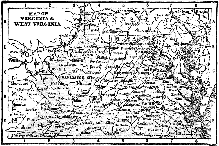
Description: A map from 1898 of Virginia and West Virginia showing principal cities and towns. "Virginia — Named in honor of Elizabeth, the Virgin Queen. One of the thirteen original States. Called the ‘Old Dominion’ and ‘The Mother of Presidents.’ First English settlement in America, 1607. Slavery introduced 1619. Seceded May, 1861; re–admitted January, 1870. Capital of Confederacy moved to Richmond 1861. West Virginia — Composed of northern and western counties of the original State of Virginia. Called ‘Pan Handle State.’ History up to 1861 same as that of Virginia. Denounced passage of secession ordinance April 22, 1861. Admitted as a State June 20, 1863, and Wheeling made the capital. Capital changed to Charleston 1870. Moved again to Wheeling 1875, and to Charleston again in 1884." — Edison,1898.
Place Names: South Atlantic States, Charleston, �Grafton, �Beverly, �Wheeling, �Parkersburg, �Richmond, �Alexandria, �Fredericksburg, �Staunto
ISO Topic Categories: boundaries,
inlandWaters,
location
Keywords: Virginia and West Virginia, physical, physical features, boundaries,
inlandWaters,
location, Unknown, 1898
Source: Thomas F. Edison, Edison's Handy Encyclopaedia of General Information and Universal Atlas (Chicago, IL: Laird and Lee, 1898) 502
Map Credit: Courtesy the private collection of Roy Winkelman |
|