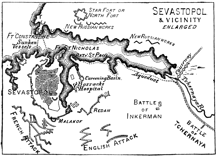
Description: Map of the Crimean seaport, including sites for the Battle of Inkerman and the Battle of Tchernaya, the Russian fortifications, the French and English points of attack, and the sites of two sunken vessels near the harbor mouth. "Sebastopol, or, as it is sometimes written, in accordance with the modern Greek pronunciation, Sevastopol, (sebastopolis, the 'august city,') a Russian seaport, fortress, and arsenal in the Crimea, in the government of Taurida, near the S.W. extremity of the Crimea." — W. H. DePuy, 1881
Place Names: Ukraine, Sevastopol, �Sebastopol, �Fort Constantine, �Fort St. Nicholas, �Crimea, �Black Sea, �Tchernaya River,
ISO Topic Categories: inlandWaters,
society
Keywords: Sevastopol and Vicinity, physical, �historical, physical features, other military, inlandWaters,
society, Unknown, 1854–1855
Source: W.H. DePuy, People's Cyclopedia of Universal Knowledge: V.2 (New York, NY: Phillips & Hunt, 1881) 1584
Map Credit: Courtesy the private collection of Roy Winkelman |
|