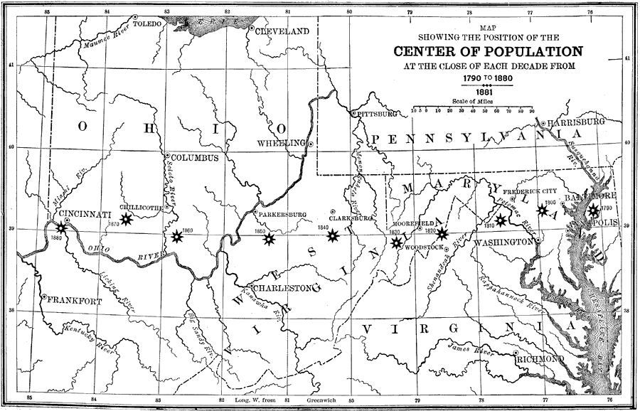
Description: The theoretical position of the mean center of population in the United States at the close of each census decade from 1790—1880.
Place Names: Demographics, Washington D.C., �Cleveland, �Annapolis, �Richmond, �Cincinnati, �Ohio River, �populatio
ISO Topic Categories: boundaries,
society,
inlandWaters
Keywords: Center of U.S. Population, physical, �political, �statistical, �historical, physical features, major political subdivisions, population, boundaries,
society,
inlandWaters, Unknown, 1790–1880
Source: W. H. DePuy, People's Cyclopedia of Universal Knowledge: V.2 (New York, NY: Phillips & Hunt, 1881) 1981
Map Credit: Courtesy the private collection of Roy Winkelman |
|